Support
What data does tcpScancyr need to process a tunnel project?
TcpScanCyr needs the point cloud captured by the scanner, the project alignment (horizontal and vertical), the superelevation data and the definition of the tunnel template. Each item is detailed below.
Point cloud
File formats supported are:
ArcView ASC
ASTM E57
Faro FLS
Leica FZS, PTS, PTX, XCF
LIDAR LAS, LAZ
Riegl RDBX
Text TXT, XYZ
Topcon CLR, CL3
It is enough to send a point cloud no longer than 200 meters.
Alignment
Horizontal and vertical alignments, preferably in LandXML format.
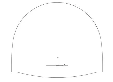
Tunnel Template
Simple CAD drawing in DWG or DXF formats.
The tunnel template must be represented as a closed polyline. It is also needed the insertion point of the alignment in the tunnel template in X and Y axis, as shown below.