
tcpGPS
Workspace - GPSv2
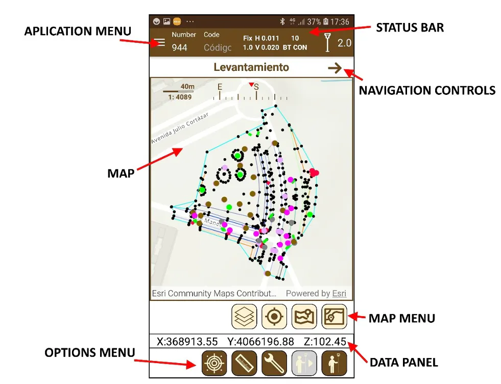
Figure 34 shows an image of the workspace as presented at start-up. The following parts are distinguished:
Map: The map is the main working element since it is where the points and information about them are displayed.
Map menu: Various options for working with the map are displayed in the map menu, such as accessing the layers presented in the map, zoom extension, GPS tracking, and map mode.
Working menu: Options for carrying out work regarding surveying, staking out, points, etc. are displayed in this menu, depending on the section being accessed.
Application menu: Options to browse through the different sections of the application are displayed in this menu, such as surveying, staking out, or project.
Status toolbar: Information regarding the GPS and Bluetooth status. Additionally, fields for setting the number, code and antenna height of the receiver are available.
Navigation controls: This menu has buttons to change the working mode in those templates that are allowed, as well as additional options, also depending on the template.
Data panel: This space is used for showing information and data needed in the current working section.
 |
|---|
Figure 34. Workspace |