
tcpTunnel Scan
Points - TSCAN1
6.1 Points
This option allows one to do point measurements manually.
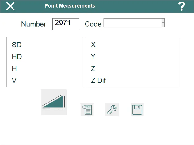
The Number of the point (alphanumeric) must be entered and, optionally, the Code, which can be selected from the program\'s database.
For each observation the program displays the geometric distance (SD), the horizontal or reduced distance (HD), the horizontal (H) and vertical (V) angles, the X, Y, Z coordinates and the height difference (Z Dif) between measured point and standing station.
The point will not be stored until the  button is pressed or automatically if this option has been set in configuration. In addition to the information in the points file, the program stores the raw observation data in the current survey file.
The  button allows one to access the data of the current points file.