Support
How to create a CRS for Spain?
REQUIREMENTS
tcpGPS v2.9.0+
Details
Create a New Project.
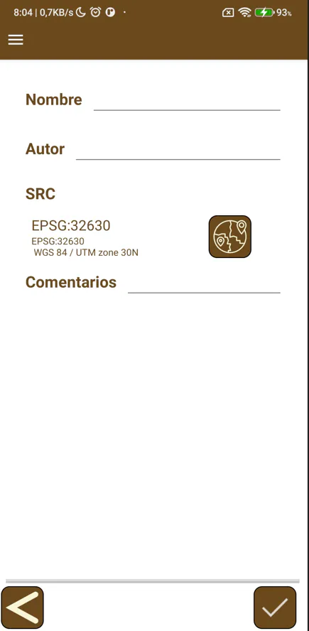
Click the button located to the right of the Offset (Coordinate Reference System) label to open the screen displaying the list of predefined coordinate systems.
| 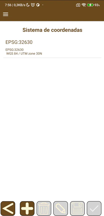 |
Click the + button to open the screen where the parameters for a new coordinate system are selected.
| 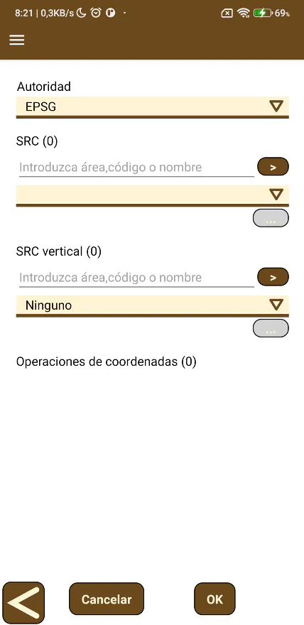 |
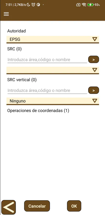
Select EPSG as the Authority.
Enter Spain in the text box under the Offset label, and click the > button on the right. It does not matter if it is written in uppercase or lowercase. All coordinate systems available for Spain will be displayed in the List.
 | 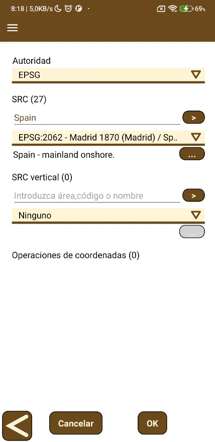 | 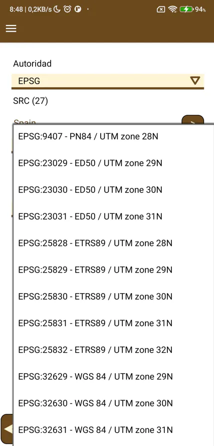 |
For the Peninsula and Balearic Islands, select EPSG:25829, EPSG:25830 or EPSG:25831, which correspond to UTM zones 29, 30 or 31, respectively. If any code appears repeated due to another search filter being applied, you can select any of them, as it will not affect the internal conversion parameters.
For the Canary Islands, select EPSG:4082 for UTM zone 27, or EPSG:4083 for UTM zone 28.
If the Vertical T. Datums, described in the next step, is not selected, the altitudes calculated by the program are relative to the Ellipsoid.
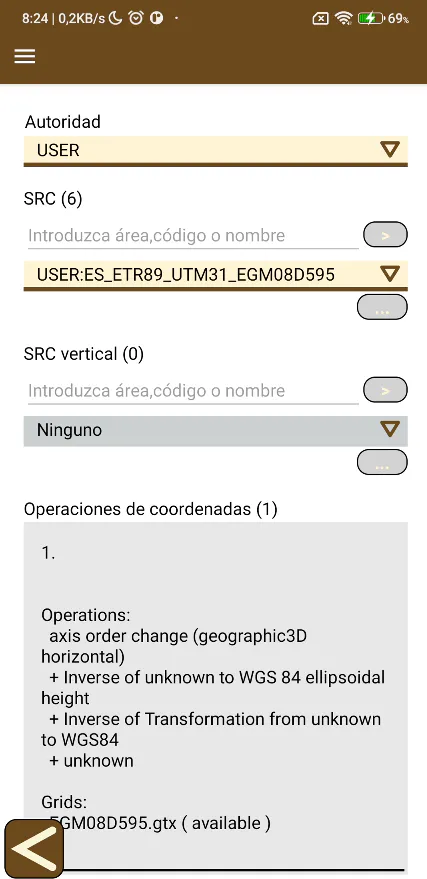
For Catalonia, there is a user coordinate system, which is available by selecting USER as the Authority and ES_ETRS89_UTM31_EGM08D595 as the Offset. In this case, it is not necessary to set a search Filter.
Furthermore, this coordinate system includes the EGM08D595 geoid, therefore, the elevation calculated by the program is geoidal (orthometric). It will not be necessary to set a Vertical T. Datums.
To add a geoidal model to the coordinate system, enter Spain in the text box under the Vertical T. Datums label, and click the > button on the right. It does not matter if it is written in uppercase or lowercase. All vertical coordinate systems available for Spain will be displayed in the List.
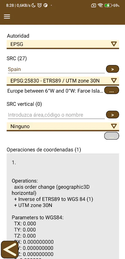 | 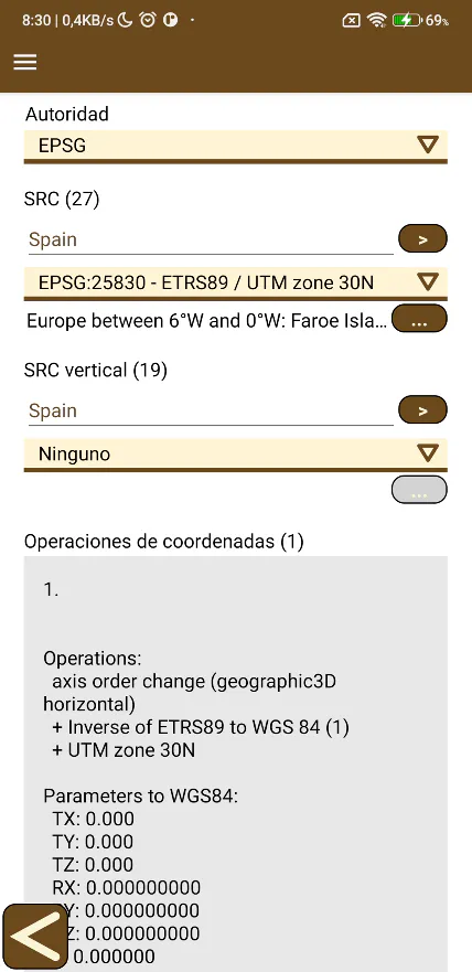 | 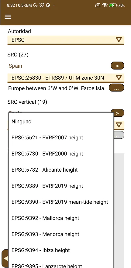 |
For the Peninsula, select EPSG:5782 -- Alicante height and for the islands, select the corresponding name.
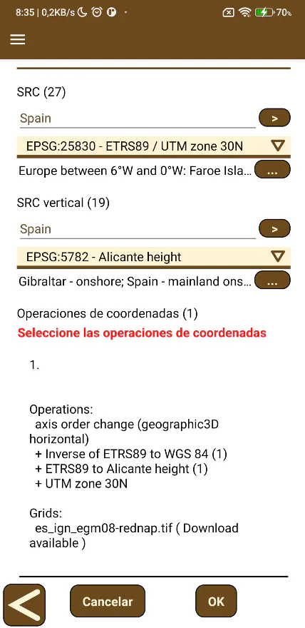 | 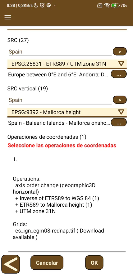 | 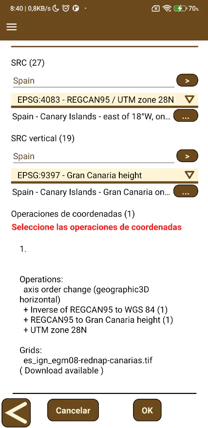 |
In the Coordinate Operations list, select the only available operation, which shows the name of the geoid (Grids) as es_ign_egm08_rednap.tif for the Peninsula and Balearic Islands, or es_ign_egm08_rednap-canarias.tif for the Canary Islands.
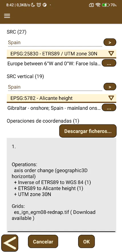
Click the Download FILES... button. Once the necessary FILE is downloaded, a Control Overlapping message will be displayed and the button will be hidden.
| 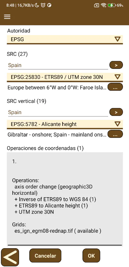 |
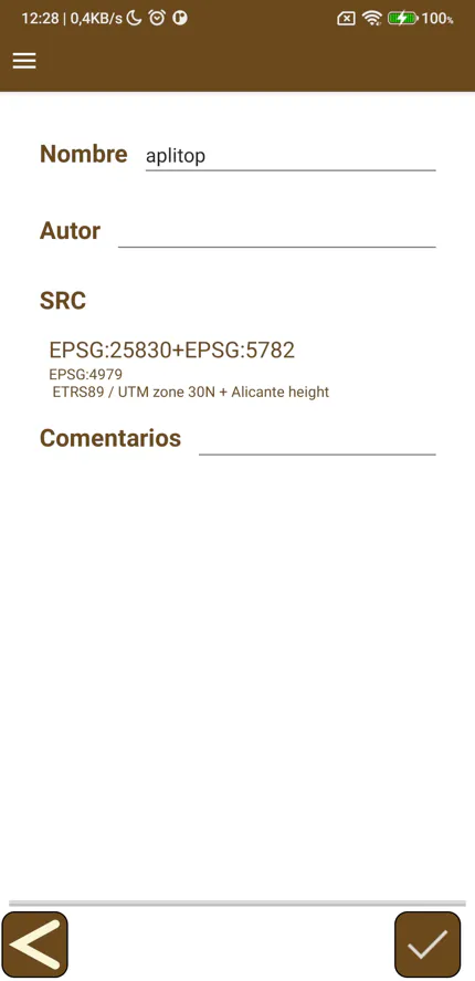
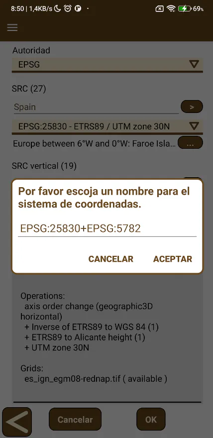
Click the OK button, set the Name of the coordinate system and click Accept.
The coordinate system will be available in the list of predefined systems.
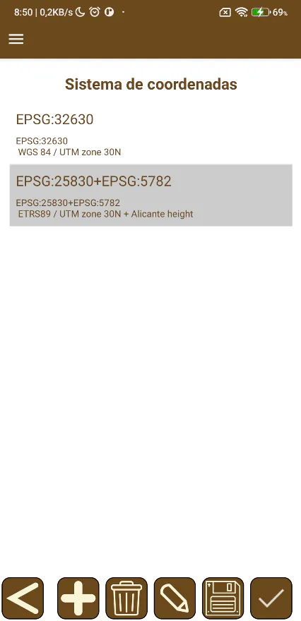
Select the created system and click the accept button.
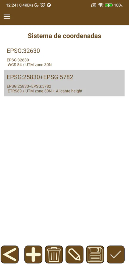
The project will be configured with the new coordinate system.