tcp PointCloud Editor
AI classification with outdoor model - PCE
4.8 AI Classification with Outdoor Model
-
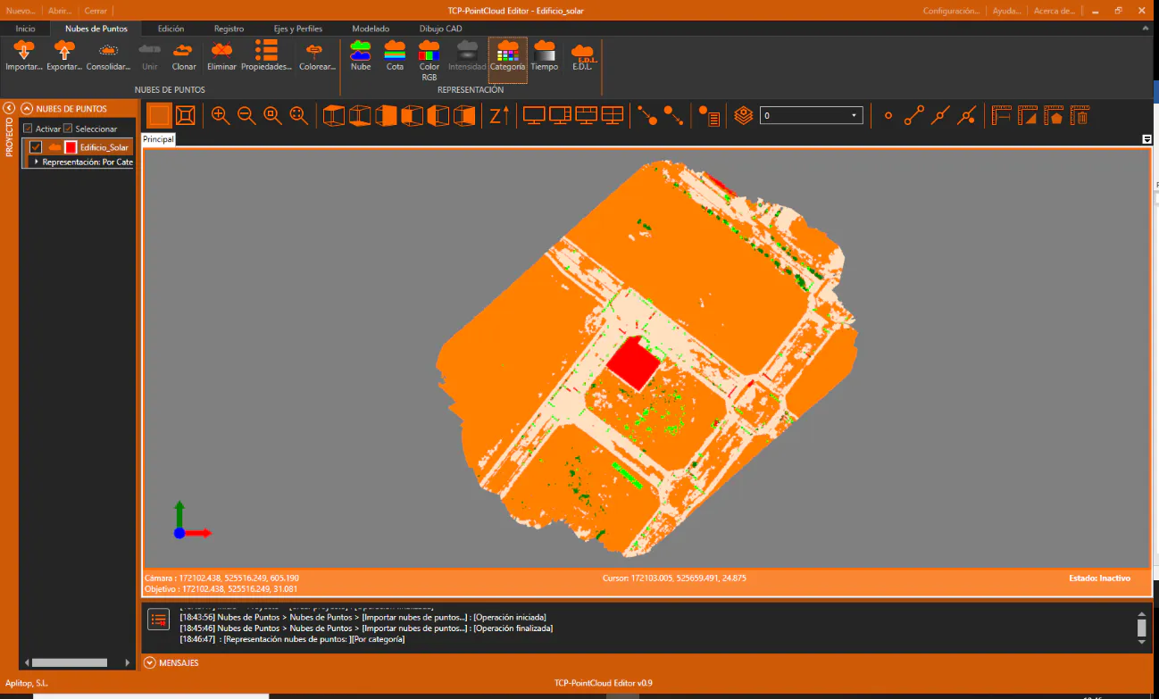
We are going to process the point cloud created by a photogrammetry application, which also includes a provisional classification by categories. Start by creating a new Building_plot.pce project, and import the Edificio_solar.las point cloud located in the 3-DRONE folder. Set the point cloud symbology by categories.
-
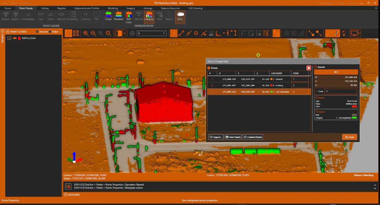
We will examine the categories assigned to the points, in order to check for classification errors. Activate Point Reference, press the Point Properties button and select some points in the cloud to check your data in the information window. Activate E.D.L. to better highlight the points.
-
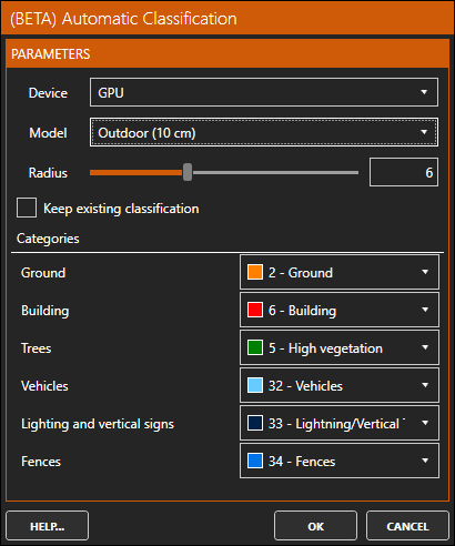
Next, we\'ll run the Artificial Intelligence-based auto-classification process (beta). To do this, activate the Edit ribbon, and within the CATEGORIES group run the AI Classify option. Under Device, select GPU if the graphics card meets the requirements for classification, or CPU if it doesn\'t. Select the Outdoor (10 cm) model, leave the Radius by default (it will automatically set to your system specifications) and uncheck the Keep Existing Classification box.
-
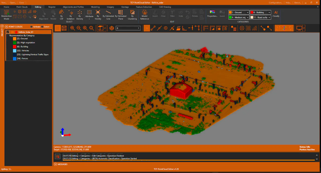
Press OK to proceed with the classification. After the calculation is complete, display the point cloud with category-based symbology and expand the legend of the table of contents.