
tcpGPS
Roads PRO version
When entering the road edition (Menu> Edit> Roads) a list of the roads that are currently in the project is presented.
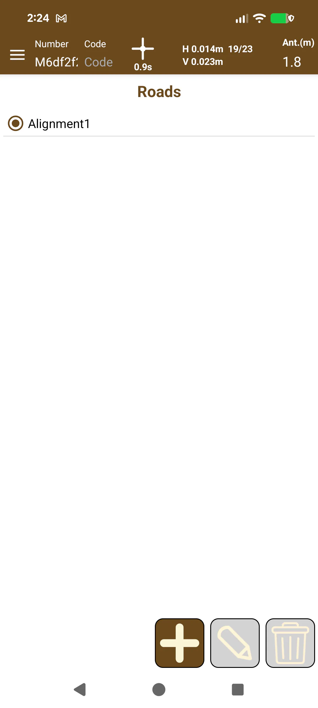 |
|---|
Figure 106. List of roads |
For the management of the list of roads, the following options are available:
 | Adds a new road to the list. It can be imported from a .eje file (created from TcpMDT), a LandXML file or an IFC file version 4.3. In these two last cases, all roads included in the file will be imported, including their vertical alignments and all the cross-sections. |
 | Enter the road edition template where you can associate a vertical alignment and the cross templates to it. |
 | Remove the selected road and all the elements associated with it. |
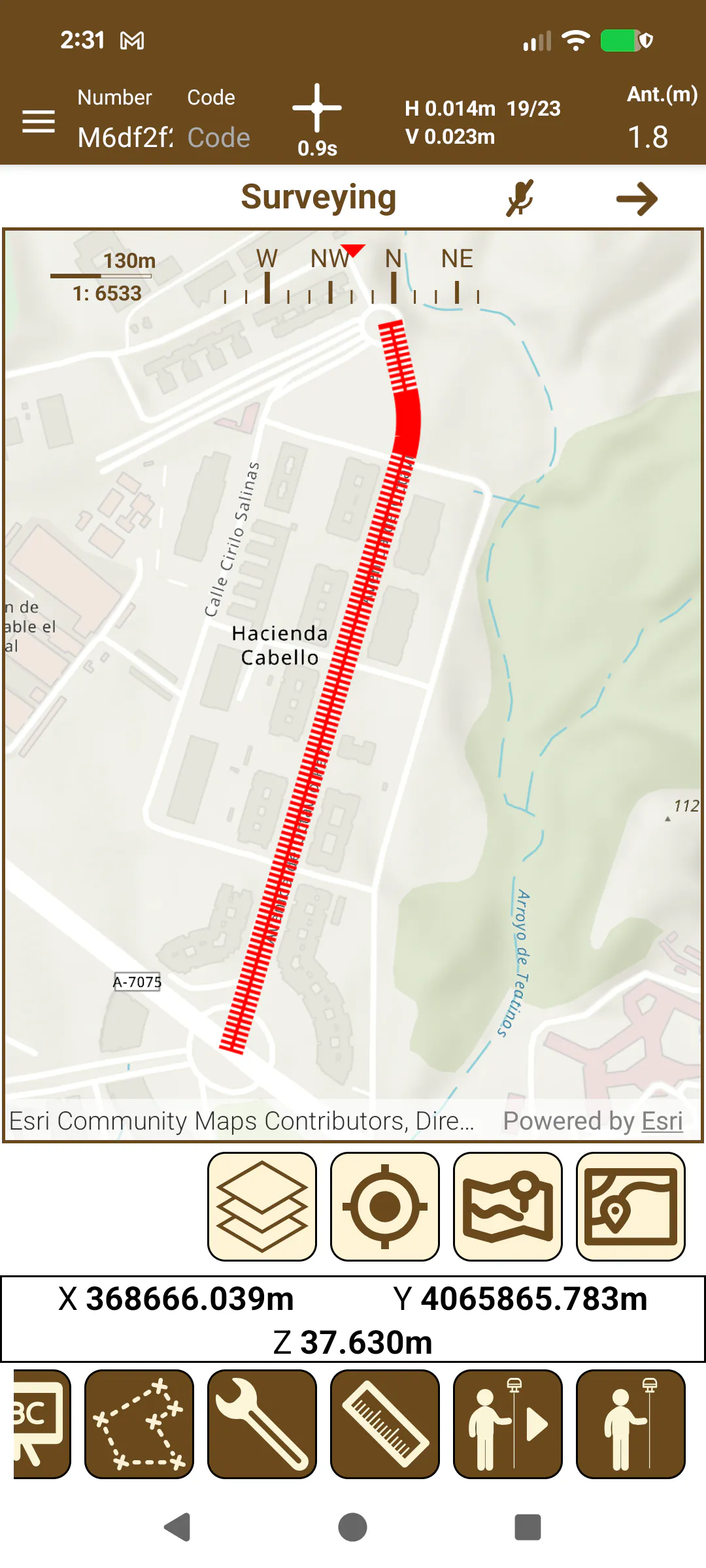
These roads are shown in the survey template of the application in blue and red which is currently the active road, selected on the list by clicking on the marker on the left.
 |
|---|
Figure 107. Roads in surveying |
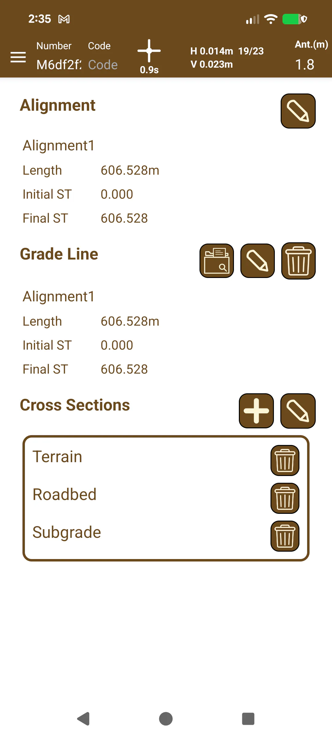
When the horizontal alignment of a new road has been loaded, you will go directly to the editing screen, where you can select a vertical alignment and make a list of files of templates that will be associated with that road.
The files that are supported are:
.eje files that contain the horizontal alignment of the road.
.ras files that contain the information of the vertical alignment.
.tra files that contain the cross-section layers of the road.
These extensions correspond to the native files created by the TcpMDT application, although it is possible to use the LandXML format, of which the entities supported are:
Alignment: It contains the points that form the horizontal alignment of the road.
Profile: It contains the vertical alignment data.
CrossSects: It contains the data of the templates of the road.
 |
|---|
Figure 108. Editing a road |