
tcpGPS
Exporting raw data - GPS v2
16.3 Exporting raw data
The raw data contained in the application associated with points taken during a survey can be exported to .gps format, which looks like this:
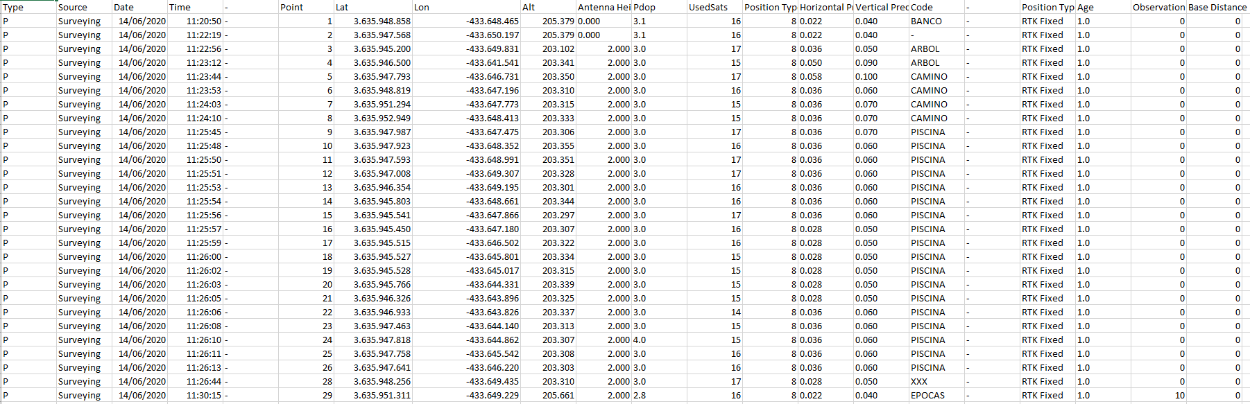
Two files will be generated when exporting raw data, both with .gps extension:
-
The first one with observation basic data (or the average of the observations if the point was taken using more than one epoch), for instance "Example.gps".
-
The other one is a detailed file with all observations of each point, for instance "Example_Details.gps".
Two types of lines exist in this format. Lines starting with # contains project information:
-
Projected SRC: Projected reference coordinates system.
-
Geodesic T. Datums: Transformation of geodesic datums.
-
Vertica SRC: Vertical reference coordinates system.
-
Vertical T. Datums: Transformation of vertical datums.
-
Local system.
-
dX, dY, dZ: Additional offsets applied to local system.
Lines starting with P or B contains information about the measured points:
- Base (B) or Point (P).
-
Source.
-
System date.
-
System time.
-
Name of the reference base. If "-" is shown, the base was configured in other working session. When working using NTRIP server, the name of the node is added.
-
Point name.
-
WGS84 Latitude.
-
WGS84 Longitude.
-
WGS84 Altitude.
-
Antenna height. Offset is not included.
-
PDOP.
-
Number of used satellites.
-
Position type identifier.
-
Horizontal precision.
-
Vertical precision.
-
Point code.
-
File where the point is stored.
-
Position type description (Fixed, Floating, Autonomous, etcetera).
-
HDOP.
-
VDOP.
This format is compatible with Aplitop\'s TcpMDT office software, so that the points are drawn automatically in CAD, being able to also consult all the raw data, as well as the linked images and voice notes. It also has numerous tools to create digital terrain models, generate contour lines, draw profiles, calculate volumes, etc. See https://www.aplitop.com/applications-topographic.