
tcpGPS
Exporting points - GPS v2
16.2 Exporting points
Points gathered in tcpGPS can be exported to the following formats: KML, KMZ (Point Images), PUN, CSV, TXT, DXF, Shape, GPX, TopStation and GML. A special type of exportation is included, called, MDT, where a .pun and a .gps files are generated alongside associated images to use them into TcpMDT.
It is possible to use two different modifiers in exporting points:
Exporting points using a different Coordinate System: This will use an already existing Coordinate System that has been previously defined in the app. They will be transformed and then exported. The two coordinate systems must be compatible with each other, or the exported data will be incorrect.
Exporting a point range: This allows for the exporting of a range of points from the project database, from X to Y, defined by the user. The confirm button must be pressed once a range has been decided for it to save the range and obtain the points.
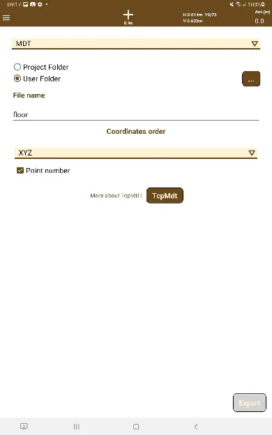 | 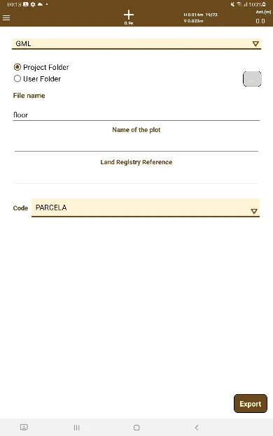 | 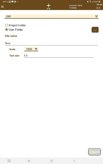 |
|---|---|---|
Figure 147. Point export menu | Figure 148. Export to GML format dialog box | Figure 149. Export to TXT, DXF and KML formats dialog box |
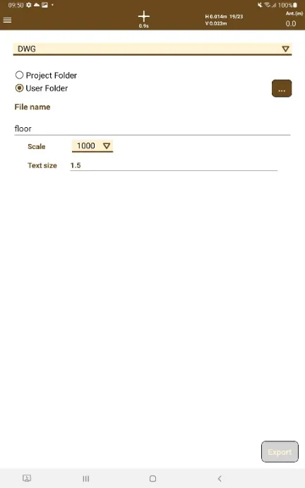
Exporting DXF y DWG
In this case, options for setting the size of the texts represented in the file are available:
Scale: scale for adjusting the size of the text to the map.
Size: size of the text for the scale defined previously.
 |
|---|
Figure 150. DWG export screen |
Exporting to TXT
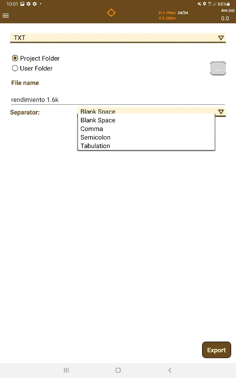
When exporting to TXT, it is possible to choose the desired separator that the point file will have. The options are Blank Space, Comma, Semicolon and Tabulation.
 |
|---|
Figure 151. TXT Export screen |
Exporting to Shape
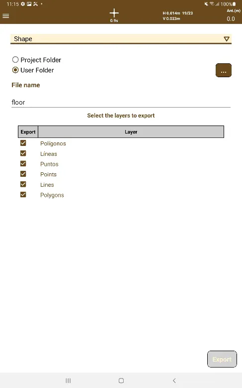
When export to Shape is selected, the user can select the layers he wants to export. A shape file is generated for each layer depending on the type of entities the layer contains, as well as a .prj file containing the projection and coordinate system of the current project.
 |
|---|
Figure 152. TXT Shape Export Screen |
Exporting to CSV
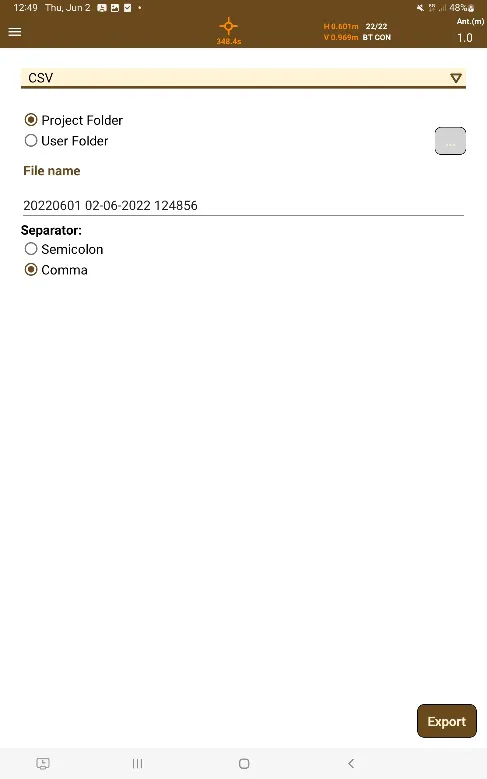
When exporting to CSV format it is possible to choose which separator for the CSV files, between Semicolon separator and a Comma separator.
 |
|---|
Figure 153. CSV Export Screen |
Exporting to Custom Format
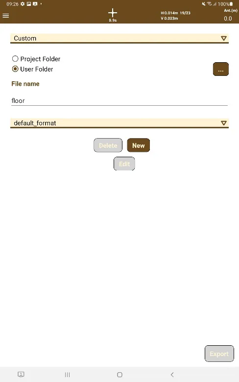
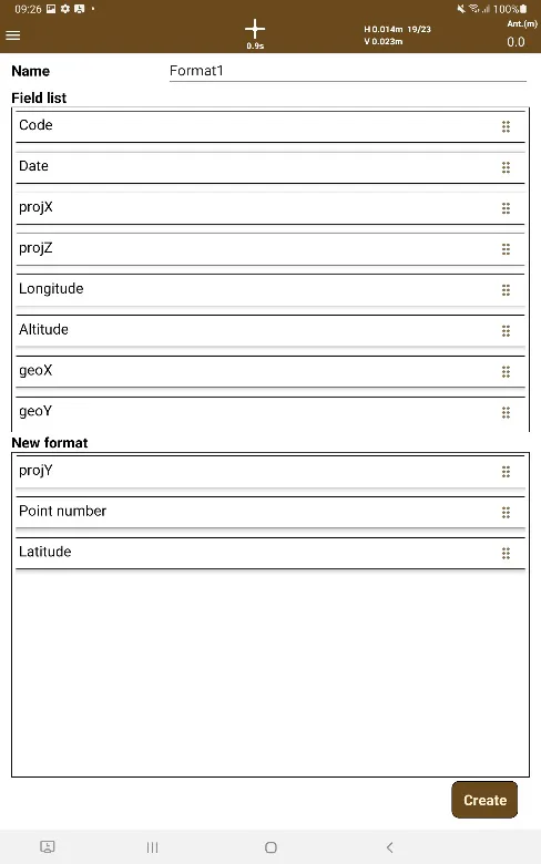
Additionally, the option to design custom formats has been implemented by selecting the Custom option, which we can be used to customize the attributes and types of data that the file will contain, adding to the name the extension with which we want to save the file.
By default, the app shows a profile named "Default", but we will have the possibility of creating our own custom formats with the supported attributes, in order to export the points with those characteristics added to those profiles.
The exported files will be saved in the local application file in the folder tcpgps/project /custom.
 |  |
|---|---|
Figure 154. Custom format export | Figure 155. Custom format attributes edition |