
tcpGPS
Editing points list - GPS v2
16.11 Editing points list
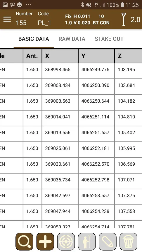
Points gathered using tcpGPS are stored in the database associated with the project. The stored data can be viewed in the List of points in the Edit section (Figure 160).
Basic data
General information of the point as it was gathered, also considering the coordinate system used. Other information like whether the point has attached an image or a voice note is shown in that list in the form of icons.
 |
|---|
Figure 160. Basic data list |
Raw data
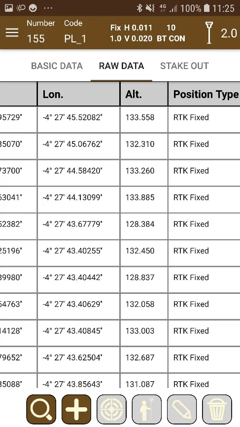
Complete information of the point for later processing. Stored raw data fields are date and time, source from where the point was stored, antenna height, latitude and longitude, height, position type, horizontal and vertical precisions, pdop, hdop, vdop and number of satellites.
 |
|---|
Figure 161. Raw data list |
Staking out data
 |
|---|
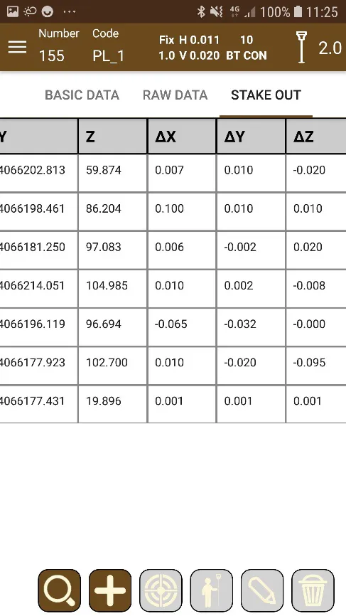
Figure 162. Stake out data list |
Information for points that have been staked out. In this list are shown the differences between the point measured originally and the point got in the staking out process. The last staking-out performed on a point is only shown if it has been done several times.
Options
On these lists, you can search for specific points by their number or by their code, options are available in the button  .
It is also possible to select a point from any list and select from a range actions to perform on it:
 This takes the user to the surveying section by centering the view on the selected point.
 This takes the user to the staking out section with the selected point ready to start the operation.
 This takes the user to the Details of the point section, from where information about the point can be viewed.
 Allow the user to add a point by typing its geographic or projected coordinates.
 Allow to remove the selected point.
Point Details
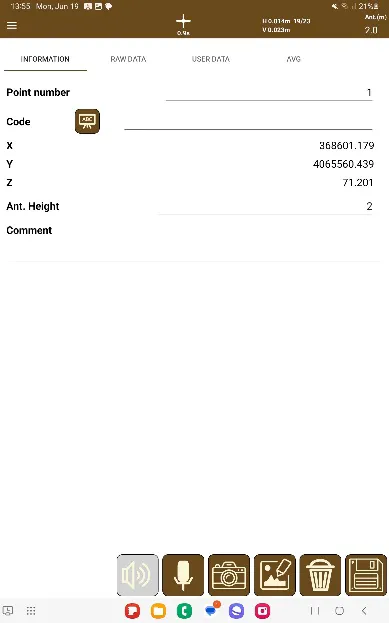
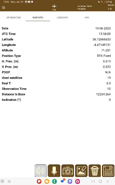
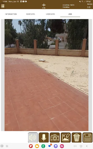
This provides detailed information about the point, not only with respect to its numerical data, but also making it possible to associated multimedia information such as photos and voice notes with it. Said photos will save the raw data of Latitude and Logitud from the point in the image's Exif header. Additionally, it is also possible to edit the user data defined by the layer associated to the code of the point (see GIS - GPS v2 ).
tcpGPS allows multiple images to be associated with a point.
 |  |  |
|---|---|---|
Figure 163. Basic point information | Figure 164. Raw point data | Figure 165. Information and multimedia data associated with the point |
Point Image Editing
Pressing the  button or performing a long press on the image will open the point image edit screen. The image will be shown alongside several controls to perform the point image editing:
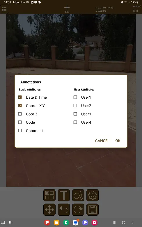
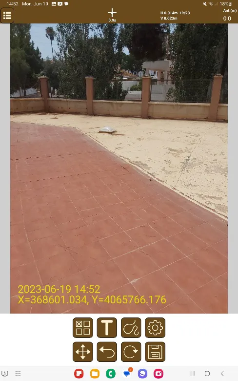
Annotations
 : Opens a dialog to be able to add point information to the image. The information is:
Date & Time
Coordinates X, Y
Coordinate Z
Code
Comment
User Attributes 1, 2, 3 & 4
 |  |
|---|---|
Figure 166. Annotation Selection | Figure 167. Annotations in Image |
Text

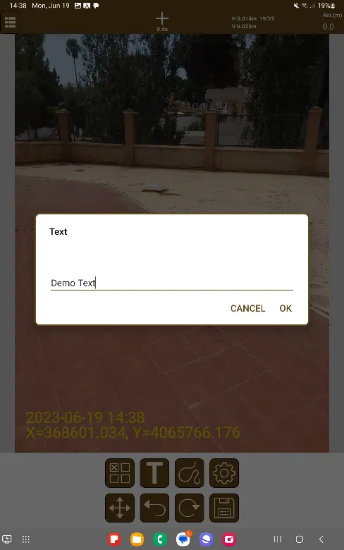
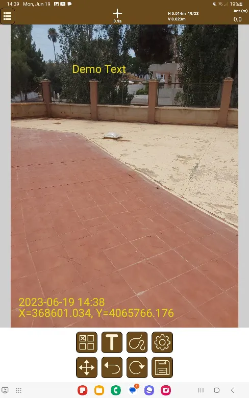
: After pressing the button, a new dialog will open where it's possible to write the text to add to the image. Once the text has been written, once the image is pressed, the text will be located where the image had been touched, aligned left to right.
 |  |
|---|---|
Figure 168. Text to add in image | Figure 169. Text added in image |
Brush

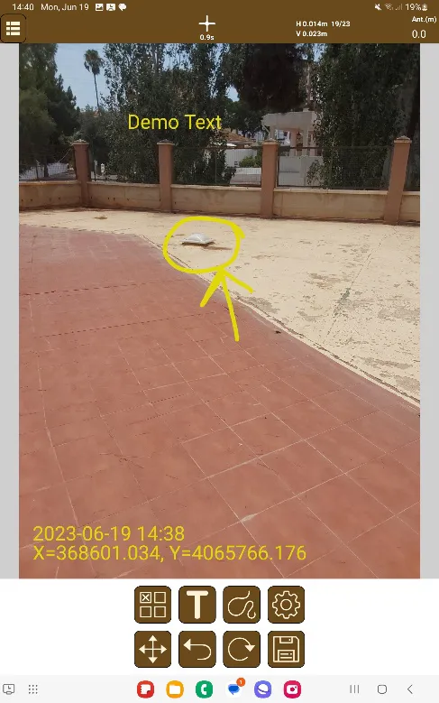
: Alows to freely draw in the image using the touchscreen.
 |
|---|
Figure 170. Drawing on the image |
Configuration

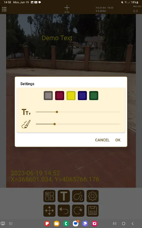
: Allows modifying of the color and size, of both the text and the brush tool. In the next figure is shown the default configuration.
 |
|---|
Figure 171. Drawing Configuration |
Move
 : Moves the last element drawn in the image.
Undo
 : Undoes the last element drawn in the image.
Restart
 : Erases all the graphical element in the image.
Save
 : Saves all graphical changes done upon the image.
Details of the polylines
Like point features, polylines and polygons created in the survey may also have user data associated with it depending on the layer their code is associated with.