
tcp PointCloud Editor
Create geotag - PCE
12.3 Create Geotag
Location
- Ribbon menu
- Geotags
- GEOTAGS
- Create (Create Geotag)
Description
With this command you can create a new geotag in the project.
Parameters
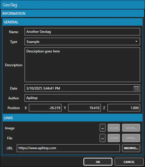
| Name | Meaning |
|---|---|
| Name | The name of the geotag |
| Type | The type of the geotag. Use type as a "category" of geotag |
| Description | A description of the geotag |
| Date | The date of the geotag |
| Author | The author of the geotag |
| Position X | The X coordinate of the geotag |
| Position Y | The Y coordinate of the geotag |
| Position Z | The Z coordinate of the geotag |
| Image | An image associated with the geotag |
| File | A file associated with the geotag |
| URL | A URL associated with the geotag |
How to use
-
Click on the "Create Geotag" command in the "GEOTAGS" menu.
-
Make sure you have some form of entity reference enabled.
-
Designate the insertion point of the geotag on the 3D viewer.
-
In the Geotag dialog, fill in the various information fields associated with the geotag.
-
You can also associate an image, a file/document and a URL (web page, for example).