
tcp PointCloud Editor
Geotags representation - PCE
12.5 Geotags Representation
Location
- Ribbon menu
- Geotags
- GEOTAGS
- Representation (Geotags Representation)
Description
This command displays the geotags representation dialog.
Parameters
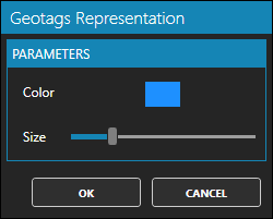
| Name | Meaning |
|---|---|
| Color | The color in which geotags are displayed in the 3d viewer |
| Size | The size in which geotags are displayed in the 3d viewer |
How to use
In the Geotags Representation window you can set the colour and size in which geotags are displayed in the 3d viewer.
The same colour and size shall be applied to all geotags in the project.