
tcpGPS
Editing the shape layer - GPS v2
9.2 Editing the shape layer
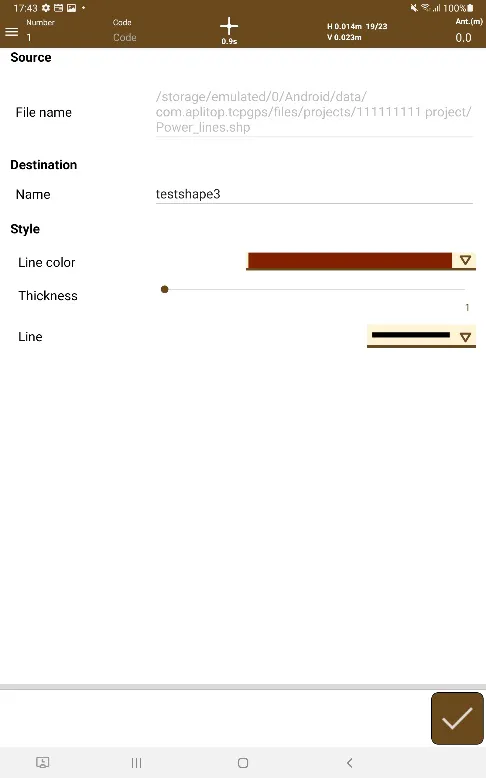
A shape layer manages a file of this type to be displayed in the workspace (Figure 56). In order to be able to load these types of files, it is necessary to have four different file types in the same .zip file:
.shp: This is the SHAPE file with the information to be displayed.
.shx: This is the associated index file.
.prj: Projection file indicating the system on which the map was made. (optional)
.dbf: Database with information associated with the points and geometries of the map.
Shape files containing punctual, linear or polygonal geometries, both 2D and 3D, are supported.
These files can be loaded from the internal storage of the device or Google Drive, using Android's File Explorer. Clicking the button  you will access Android's file explorer, which can access the device's files as well as the Google Account's Google Drive.
The properties to be defined for this layer are:
Layer name.
Opacity: Level of transparency of the layer.
Color: Color for lines and dots on the map.
File: File to be displayed.
 |
|---|
Figure 56. Editing the Shape layer |