
tcpGPS
Edition of wmswmts layers - GPS v2
9.5 Edition of WMS/WMTS layers
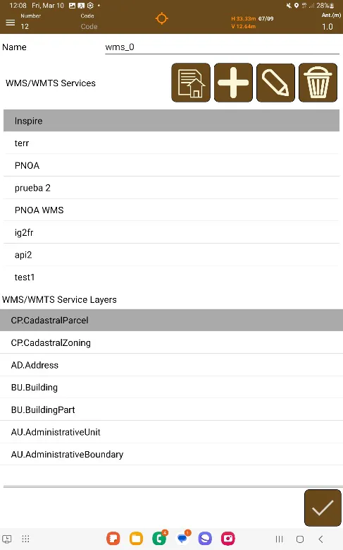
A WMS/WMTS layer manages the connection with this kind of service for loading the information related to the current working area.
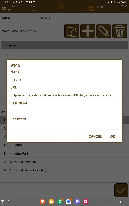
When you create a new WMS/WMTS layer, what you must do is create a new entry to connect to the desired service or use one of those that have been used previously. You can add as many services as you want, in addition to being able to edit existing ones (if there is a change in the URL that connects to it) or you can delete them if they are not going to be used or they are no longer available.
You are able to use username and password if the service you're using requires you to do so, but you can leave them blank if the service you're using has no requirement for credentials.
The functions available to edit layers of this type are:
 | Allow to import a list of WMS/WMTS servers from a TXT file with the following format: <Name> <URL> (optional: <Username> <Password>) |
 | Defines a new WMS/WMTS service by entering the corresponding URL. |
 | It allows it to modify the URL of the WMS/WMTS service, in case of error or if it has been transferred to another address or server. |
 | It allows the deletion of a WMS/WMTS service from the list, if it is not used or it is no longer available. |
 |  |
|---|---|
Figure 60. Editing the WMS/WMTS layer | Figure 61. WMS/WMTS service example |