
tcpGPS
Edition of DXF kmlkmz gml and DWG layers - GPS v2
9.3 Edition of DXF, KML/KMZ, GML and DWG layers
The DXF, KML / KMZ and GML layers contain cartographies of these types, where all the information is inside those files. These layers share the form of editing since it will be their content that establishes the parameters of each one.
The properties that can be configured on this layer are:
Layer name.
Opacity: Level of transparency of the layer.
File: File to be displayed.
As with shape layers, files can be loaded from the internal storage of the device or from a Google Drive (or some other cloud file providers) account.
DXF
The entities supported in DXF are:
ARC: Arcs (2D and 3D).
CIRCLE: Circles (2D and 3D).
POLYLINE / LWPOLYLINE: Polylines (2D and 3D).
LINE: Lines (2D and 3D).
POINT: Points (2D and 3D).
VERTEX: Vertices of polylines (2D).
TEXT: Texts.
BLOCK: Blocks (discretized into polylines)
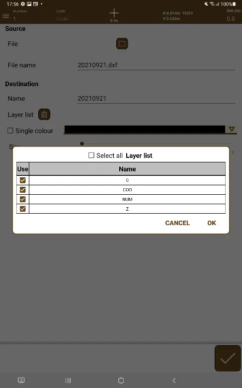 |
|---|
Figure 57. DXF Layers |
DWG
In this case, the entities supported by tcpGPS are points, lines, polylines 2D and 3D, arcs, circles, ellipses, splines, helices as well as single line texts and blocks which have been discretized into polyline entities.
KML/KMZ
The following entities are supported with the indicated structures:
Points
<Placemark>
<Point>
<coordinates></coordinates>
</Point>
</Placemark>
Polylines
<Placemark>
<MultiGeometry>
<LineString>
<coordinates></coordinates>
</LineString>
</MultiGeometry>
</Placemark>
Polygons
<Placemark>
<Polygon>
<outerBoundaryIs>
<LinearRing>
<coordinates> </coordinates>
</LinearRing>
</outerBoundaryIs>
</Polygon>
</Placemark>
GML
Geometry entities that contain the following structure are supported:
<cp:geometry> <gml:MultiSurface gml:id="" srsName=""> <gml:surfaceMember> <gml:Surface gml:id="" srsName=""> <gml:patches> <gml:PolygonPatch> <gml:exterior> <gml:LinearRing> <gml:posList srsDimension="" count=""></gml:posList> </gml:LinearRing> </gml:exterior> </gml:PolygonPatch> </gml:patches> </gml:Surface> </gml:surfaceMember> </gml:MultiSurface> </cp:geometry>
GPX
Waypoint and track entities that contain the following structure are supported:
<wpt lat="" lon="">
<ele></ele>
<name></name>
<desc></desc>
</wpt>
<trk>
<name></name>
<desc></desc>
<trkseg>
<trkpt lat="" lon">
<ele></ele>
</trkpt>
</trkseg>
</trk>
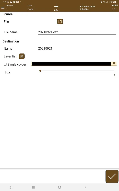 |
|---|
Figure 58. Editing the DXF, KML/KMZ or GML layers |