
tcpMDT Photovoltaic
Update tracker in elevation - PV25
7.5 Update Tracker in Elevation
This tool will allow us to modify the nominal grade in a very comfortable way from the elevation, which has been previously drawn with the Draw Elevation of Trackers or Draw Elevation of Continuous Trackers tools.
Initially, we draw the follower and on the same drawing, we create a polyline with the new nominal grade that we want to generate.
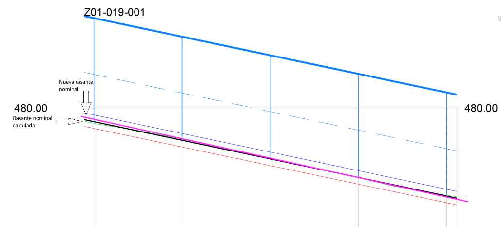
Initially, we will be asked to designate graphically the longitudinal of the terrain and then the polyline that represents the new grade, in the image, would be the magenta line.
Tracker information will be automatically updated, as well as in-plant labeling.