
tcp PointCloud Editor
Import point clouds - PCE
5.1 Import Point Clouds
Location
- Ribbon menu
- Point Clouds
- POINT CLOUDS
- Import (Import Point Clouds)
Description
This command allows the import of point clouds from files or folders. The supported file formats are: * ASCII Grid (.asc)
-
CSV Text file (.csv)
-
ASTM E57 (.e57)
-
FARO (.fls/.fws)
-
LAS LiDAR (.las/.laz)
-
Leica LGSx (.lgsx)
-
Aplitop Binary Grid (.mde)
-
Aplitop ASCII Grid (.mll)
-
Point Cloud Data (.pcd)
-
Polygon File Format (.ply)
-
Leica (.pts/.ptx)
-
Aplitop ASCII Points (.pun)
-
Autodesk Recap (.rcp/.rcs)
-
Riegl (.rdbx)
-
Text File (.txt)
-
Leica MS50 (.xcf)
-
XYZ Text file (.xyz)
Details
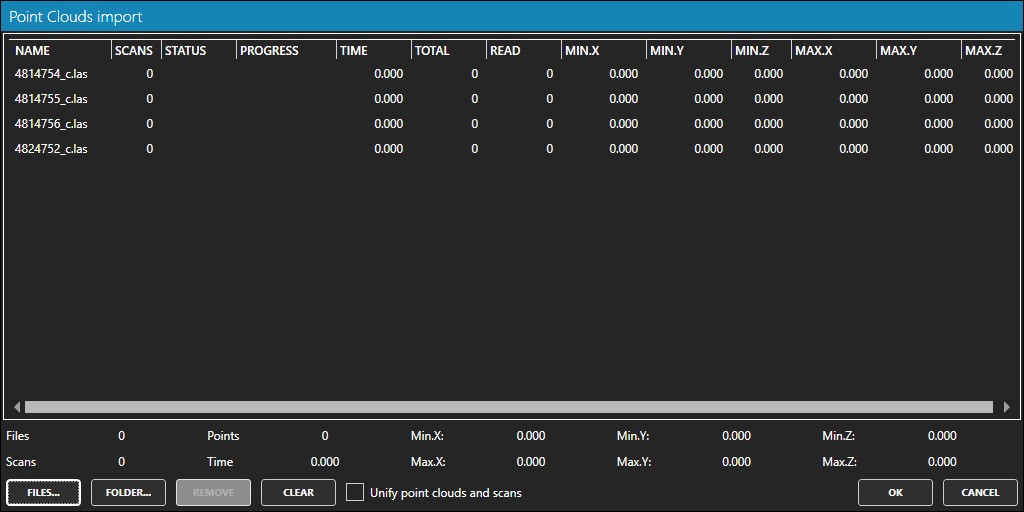
-
FILES button: Click to select the file(s) to import.
-
FOLDER button: Click to select the root folder from which files will be imported recursively.
-
REMOVE button: Click to remove the selected file(s) from the list.
-
CLEAR button: Click to remove all files from the list.
-
Unify points clouds and scans option: Check to merge all the point clouds in a single one.
How to use
-
In the Point Clouds Import window, click FILES button to select the file(s) to import or the FOLDER button, to import all the files in a folder.
-
You can remove files from the list by selecting them and clicking the REMOVE button, or clear the entire list with the CLEAR button.
-
You can merge all the point clouds in a single one by checking the "Unify points clouds and scans" option.
-
Click the OK button to import the listed files, or Cancel otherwise.