
tcpGPS
PRO roads stake out PRO version [PRO] - GPS v2
14.6 Roads stake out (PRO version)
Stake out settings
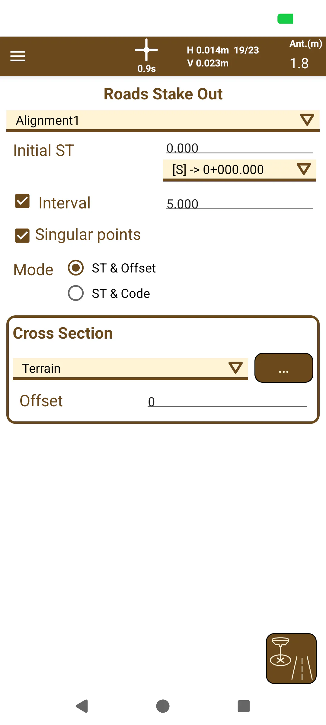
In the setting out of roads, the points referred to the horizontal alignment of the road are set out. To do this, first you must configure the point or the set of points you want to set out.
If you want to set out a single point, just indicate it in the Initial Station.
If what is desired is to stake out a set of points along the horizontal alignment or parallel to it, the option Interval should be activated, and an Initial Station indicated from which the following points of the interval will be created. Then you can modify the interval between the points that will be taken. In addition, if this option has been selected, a drop-down list with the ordered set of interval points helps the user to choose the point to be set out.
 |
|---|
Figure 136. Road stake out settings |
As an additional option, you can stake out, alone or next to the points defined in the interval, the singular points that form the horizontal alignment, marking the Singular Points option. These points are also added to the list of drop-down points and begin with an [S].
If no other option is configured, all points will be located on the horizontal alignment. However, it is possible to set out points that are at a distance from the horizontal alignment, parallel to it. To do this, you can select if you want a list of points parallel to the horizontal alignment at a certain distance (Setting out by Station and Displacement) or to use a selected point of one of the vertices of the cross templates associated with the road, defined by a code (Setting out by Station and Code).
If there is no cross section selected, only the option of setting out by Station and Displacement will be available, indicating the displacement in meters that the points will have on the horizontal alignment. If the distance is positive, they will be placed to the right of the horizontal alignment and if it is negative to the left.
When a cross section is selected from the list associated with the horizontal alignment, the setting out option for Station and Code is activated, in this case you can enter a code manually or view the list of codes from the cross-template view on the button  .
Once the list of points to be set out has been configured, the setting out of the button starts .
Stake out display
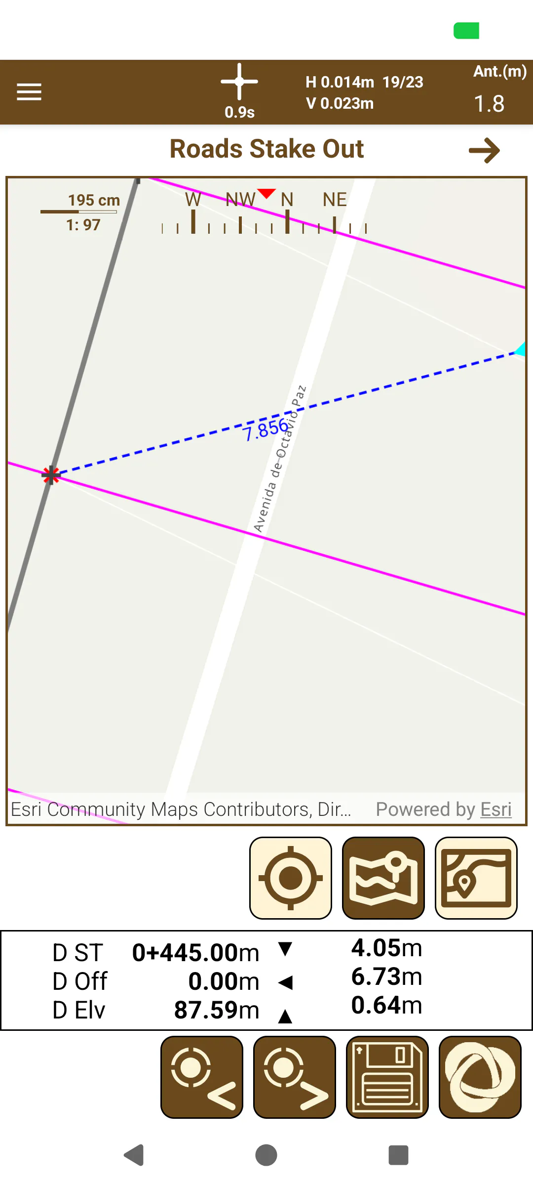
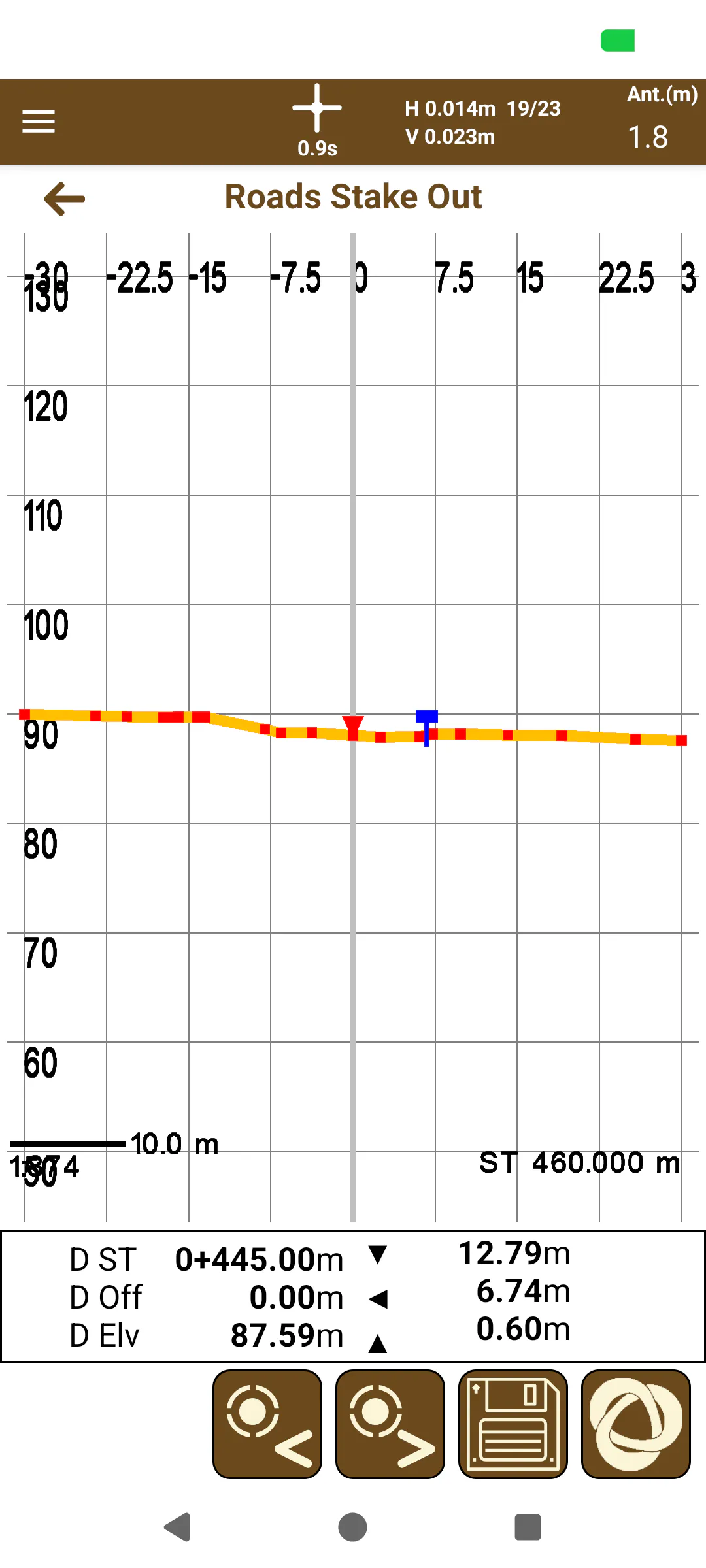
The setting out screen has two modes: setting out of a plant and setting out in elevation. The latter will be shown if a cross section has been selected and if the road has a vertical alignment associated with it. To switch between both views, the navigation menu buttons are used

 .
The information displayed on the elevation is the following:
The Station and the current displacement.
Move forward / backward from the current station to reach the point.
Movement in / out of the horizontal alignment to reach the point.
Current elevation and movement up / down to reach the slope.
Sliding the information square from right to left, you get more information:
On the left:
Destination PK
Destination Displacement
Destination Elevation
On the right:
Current PK
Current Displacement
Current Elevation
In the plant, the information of the current position marked with a celestial cross is shown.
If you have selected a range of points to set out, with the buttons 

you can change the point to set out within the list.
 |  |
|---|---|
Figure 137. Road stake out (top view) | Figure 138. Road stake out (front view) |
When the setting out point has been reached, it can be saved using the button  . In this case, two points will be saved in the project database: the original point calculated in the list of points to be set out and the point that has been marked as set out.