
tcpGPS
Distances and areas - GPS v2
10.8 Distances and areas
 |
|---|
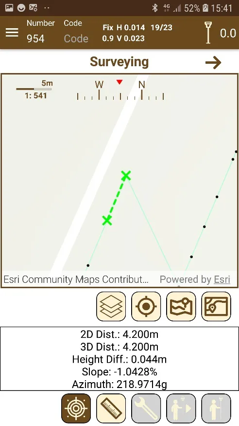
Figure 80. Measuring the distance between two points |
In this mode, the map has an additional functionality: distance and area measurement. When we press the button  the app asks the user for the kind of measure:
If distance measurement is selected, we will be instructed to choose the first point; Once selected, the second point will be requested and then the information about the distance between the two will appear (Figure 80): distance 2D (without taking into account the dimension), distance 3D, the height difference and the slope between the two points.
If area measurement is selected, you will select points over the map and the area will be built and updated each time a point is added. You must be careful because the order of the point will define the shape of the area. Number of vertices, perimeter, area and maximum and minimum height are the data shown.