
tcpGPS
Numerical surveying screen - GPS v2
10.2 Numerical surveying screen
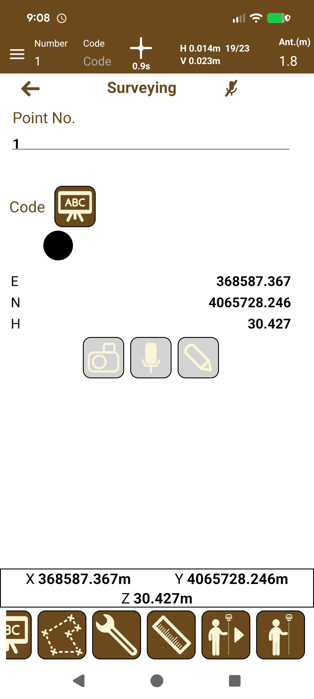
Several parameters associated with the points taken can be configured from the numerical surveying screen:
 |
|---|
Figure 64. Surveying numerical mode |
Point number: Number of the next point that will be taken. This number will increase 1 in 1 as consecutive points are taken, from the given. The number of a point is an alphanumeric text that, in the case of numbering more than one point, it will add a suffix that will indicate the numbers taken with that same initial text. For example, if the number is decided to be CRT, the first point will be CRT, but the next one will be CRT_1, CRT_2, and so on.
Code: A code that will be associated to the point, which can be selected from a predefined list or a new code created (see Point code management - GPS v2 ).
The numerical surveying screen also displays the numerical information of the current GPS position.