
tcpGPS
Survey tools - GPS v2
10.9 Survey tools
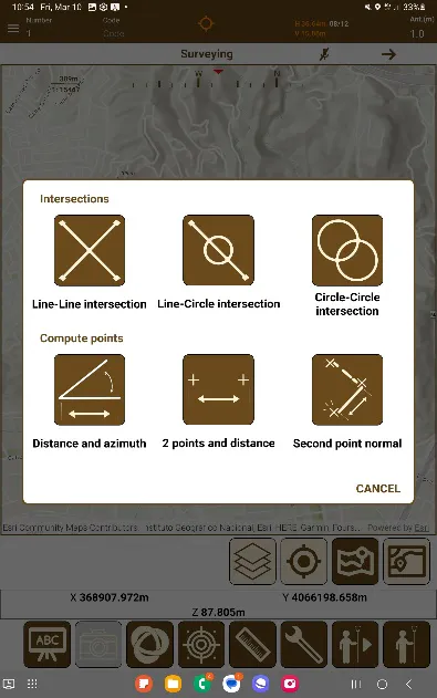
Clicking the tools button  displays a dialog box where you can find a set of tools to work with the points gathered. These tools correspond to the calculation of new points using intersections or reference points. There are three types of intersection: line-line intersection, line-circle intersection and circle-circle intersection. Three options are available for creating new points from reference points: distance and azimuth, 2 points and distance and normal of second point.
 |  |  |
|---|---|---|
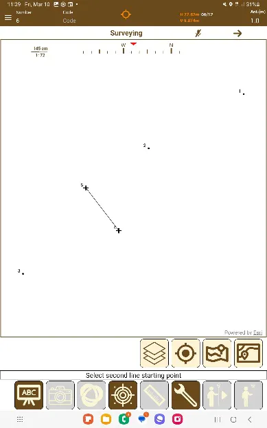
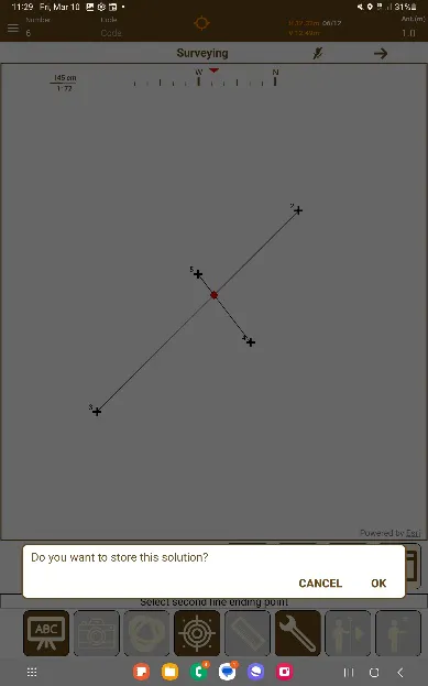
Figure 81. Surveying tools dialog box | Figure 82. Selection of points for the intersection | Figure 83. Confirmation of the intersection solution |
Line-Line Intersection
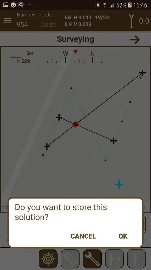
In this case, the point where two lines are cut is calculated. The application will ask the user first to click on the two points that will form the first line and then select the two points that will form the second. It will show immediately the two lines and the intersection between them. If the lines are parallel, there will be no cut off point. Next, it will ask for confirmation, if you want to save this solution.
 |
|---|
Figure 84. Intersection of two lines |
Line-Circle Intersection
 |
|---|
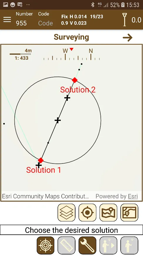
Figure 85. Line-circle intersection |
The application will ask the user first to select the two points that form the line and, next, the point that will be the center of the circle, after which you must write the radius of it. In this case, it can happen that there is no solution if the line and the circle are separated; that there is only a solution if the line is a tangent to the circle, or that there are two solutions if the line cuts the circle. The application will show the line and the circle and the intersection between them and, if there is more than one, it will ask you to choose which of the two you want to record.
Circle-Circle Intersection
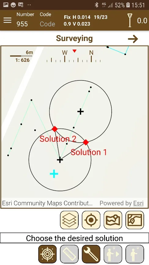
This case is like the previous one, and there may be none, one or two solutions. The application will request the user the center of the first circle and then the radius and perform the same operation for the second circle.
 |
|---|
Figure 86. Circle-circle intersection |
Distance and Azimuth
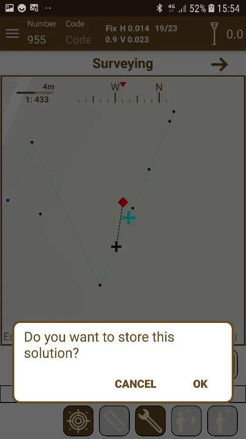
In addition to using intersection, points can also be calculated from others using the Distance and azimuth tool. The application will ask the user to choose a point from those present in the work and then enter the distance and the azimuth of the point that will be generated, taking as reference the selected point.
 |
|---|
Figure 87. Point calculated by distance and azimuth |
Two points and Distance
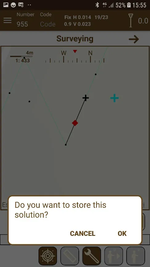
With this tool, the user can select two points a set a distance from the first point to calculate a new one, taking the azimuth between the selected points as the direction where apply the distance.
 |
|---|
Figure 88. Two points and distance |
Second Point Normal
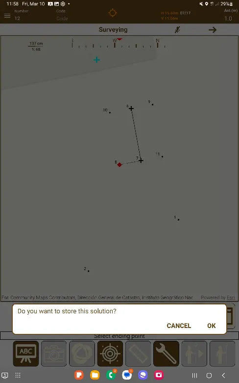
With this tool, the user can select two points and then indicate a distance in meters, and then the application will began calculating a point to the normal vector of the second point chosen, or perpendicular.
 |
|---|
Figure 89. Second point normal |
Laser Distance Meter Use
If there's a laser distance meter connected with the application, the dialog to introducing the distance (both distances and radius) changes, and a  button is added, which, when pressed, shows the following message.
 |
|---|
Figure 90. Waiting for distance meter data. |
Once the measuring button of the distance meter is pressed, this will send the measurement information to the tcpGPS application via Bluetooth, and this will be added to the text field, with a precision of 3 decimal numbers.