
tcpGPS
Point code management - GPS v2
10.6 Point code management
To classify the points, it is possible to assign them a specific code that groups them and distinguishes them from the rest. This code may be composed by a set of codes of different type for identifying the point in a better way or to define different properties for the point. Some examples of codes are shown below:
TREE
SHOULDER,ASPHALT
MANHOLE,LP_1,PT_2
As you can see in the examples above, a separator character will be used for identifying each code of the multicode. To change this separator, see Configuring the workspace - GPS v2 .
There are three types of codes in the application:
Punctual: Used for defining singular points (TREE, MANHOLE, LAMPPOST...)
Lineal: Define polylines. In this case, a sequence of points composes the polyline. The first point of the polyline will be attached the s suffix (start) and the last point the e suffix (end). Here you have an example:
ASPHALT S
ASPHALT
ASPHALT
ASPHALT E
Polygonal: Define areas or parcels. As lineal codes, a suffix for the starting point (s) and another one for closing the polyline (c) are needed. For instance:
PLOT S
PLOT
PLOT
PLOT C,POST
In the numerical survey mode, the button  displays the code management dialog. It is also possible to access the code management screen by a long click over the Code filed in the status bar.
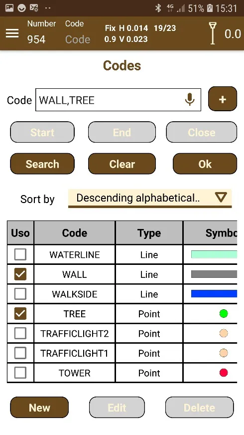
In Figure 70 dialog is shown with the list of codes available in the database of the application. This database is modified as new codes are inserted and existing ones are modified or eliminated. By clicking on the desired code and accepting the choice, the code starts to be used in the following taken points. Using this list, you can build your code or multicode (if you want to assign more than one code to the point) only by checking the Use checkbox beside each code.
Previously, it was said that a separator is needed to compose a multicode and it can be selected in Configuring the workspace - GPS v2 . If you want to add a new code to your multicode, you must click the button  to introduce the separator or type it if you know which separator is selected.
If the code is lineal or polygonal, you can add the start or end suffix for the line or the start or close suffix for the polygon, only clicking the corresponding button or typing it. This is important because when the application builds the lines or polygons it uses these suffixes as references.
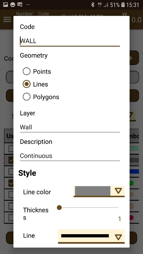
In Figure 71 it the options to edit or create a new code are displayed. The codes can be punctual or linear (depending on whether they will represent independent points or points that will make up a line or a plot). In addition, a wide base of colors is available to assign to the points that contain this code.
Depending on the type of the code, you can configure the style of the elements that use this code. For points you can define the color, size and type of symbol. For lines you can set the color, width and style of line. For polygons, apart from the style of the contour line, you can define the fill color and the level of transparency.
It must be considered that if the code of the point is a multicode, the style for its representation over the map will be the style of the first code which associated layer is visible.
 |  |
|---|---|
Figure 70. List of point codes | Figure 71. Edition and creation of codes |
Export and Edit Simplified Code Database
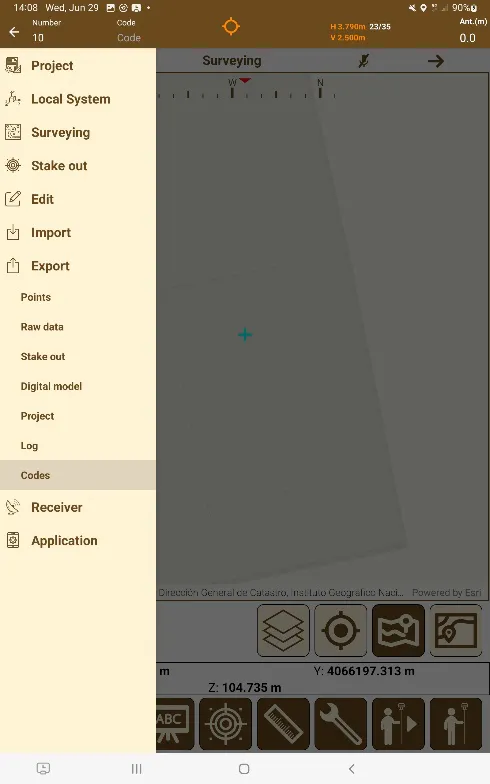
By hitting Export and then Codes, it will be asked to choose a location to export the codes file. The data of these codes will be divided into the following categories:
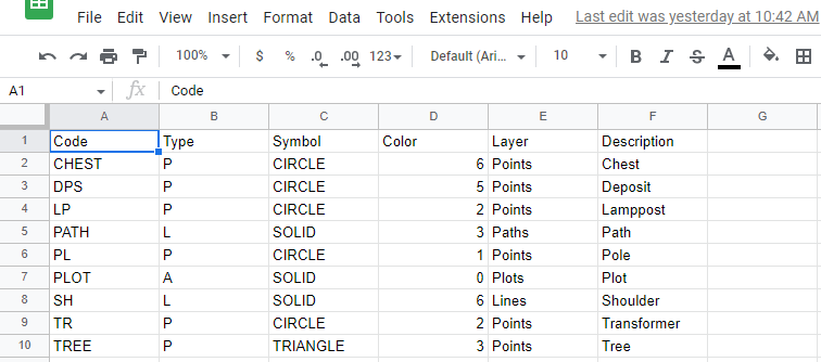
Code Type Symbol Color Layer Description
The header line should not be modified, as the software uses it to recognize the file as valid.
Field | Description | Values | Remarks |
|---|---|---|---|
Code | Point code | ||
Type | Geometry | P (point)\ | Default: P |
L (line)\ | |||
A (polygon) | |||
Symbol | Symbology | Points: | Marker for point type codes Default: CIRCLE |
CIRCLE | |||
CROSS | |||
DIAMOND | |||
SQUARE | |||
TRIANGLE | |||
X | |||
Lines & Polygons: | Line type for linear and polygonal type codes Default: SOLID | ||
DASH | |||
DASH_DOT | |||
DASH_DOT_DOT | |||
DOT | |||
SOLID | |||
Colour | Color | 0 - Black | Other values up to 255 can be defined, according to the following table: https://gohtx.com/acadcolors.php |
1 - Red | |||
2 - Yellow | |||
3 - Green | |||
4 - Cyan | |||
5 - Blue | |||
6 - Purple | |||
7 - White | |||
Layer | Layer name | The default names are: Points, Lines, and Polygons, but layers can be created with other names | |
Description | Code description |
 |  |
|---|---|
Figure 72. Export Menu | Figure 73. Editing of codes with datasheet software |
Once you have edited your file, you can save it as a .txt or .csv to import it into tcpGPS.
Import Simplified Code Database
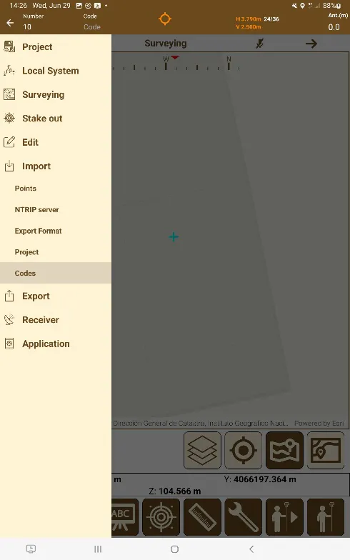
Once you have a file containing the codes you want to use, you can open the menu and access Import and then Codes to open the Code Import Dialog box.
 |  |
|---|---|
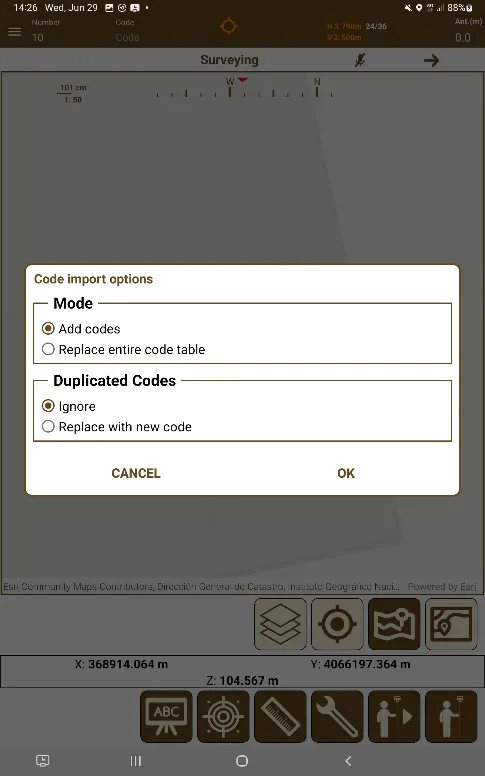
Figure 74. Import Menu | Figure 75. Code Import Dialog |
This Dialog has the following options:
Mode:
Add Codes: Adds the codes to the bottom of the already existing database.
Replace entire code table: Replaces the code database with the imported codes.
Duplicated Codes:
In case that the selected option above is Add Codes, you can choose how the application will behave regarding the imported codes with a code that already exists in the base code database
Ignore: Duplicated codes will be ignored and will not be imported at all.
Replace with new code: The imported code with the duplicated code that already exists in the base code database will replace the existing one.
Code Prefixes
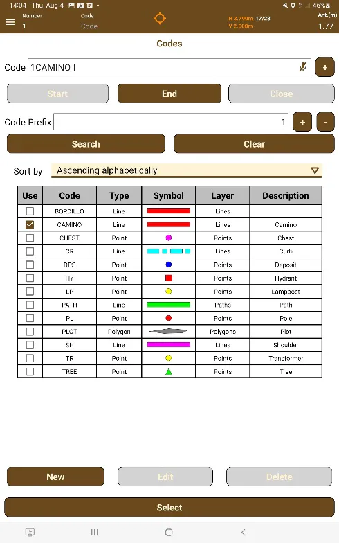
You are able to enable to code prefix option in the Configuration screen, and once it is turned on, you can access the code list screen, select a code, and increase or decrease the prefix counter.
It is also possible to add a code separator to add two codes of the same code as long as they have different prefixes by adding the separator and increasing or decreasing the prefix counter.
You can also have multicode codes with or without prefixes by using the code separator button.
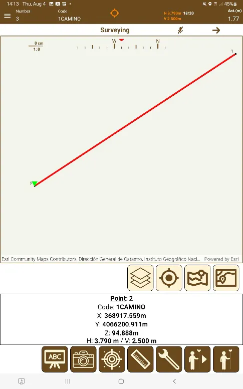
This allows the possibility of having multiple lines or polygons not finished/closed of the same code open at the same time, as long as they have different prefixes.
 |  |
|---|---|
Figure 76. Code with prefixes | Figure 77. Line using a code with a prefix |