
tcpMDT
[PRO] earthworks by fill up to an elevation - MDT25
4.31 [PRO] Earthworks by Fill up to an Elevation

This command is designed to calculate, for example, the fill volume of a platform or pond generated previously. The final result will be a new surface with the fill at the specified elevation.
The program will first ask for a point, which must correspond to the area we wish to fill. In the case of a pond, any point in it would suffice. The following dialogue box will then appear.
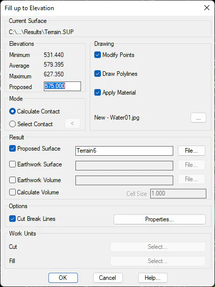
Elevations: Provides us with information on the minimum, average and maximum elevations, whereby the user will need to specify the fill elevation.
Drawing
-
Modify Points: Activating this box will change the points in relation to the new surface to be created.
-
Draw Polyline: Draws a polyline on the contour line up to the elevation to be filled.
-
Apply Material: the option of assigning a material to the new surface created at the indicated elevation. A material with a texture similar to that of water will be assigned by default and executing Route by Terrain command will provide a realistic representation of the same.
The remaining options are the same as those of the Earthworks by Terrain Elevation command.