
tcpMDT
Drawing exploration - MDT26
Drawing Exploration
In this first workflow we start from the drawing Demo_MCP.dwg, which contains the point cloud from a topographic survey of a plot. The objective is to obtain a Digital Terrain Model with contours, starting from scratch and using the assistant exclusively to execute all MDT operations.
The workflow is divided into several phases: code query, surface creation and contour generation. Profiles will then be obtained and the earthwork for a platform will be calculated.
Code query
To identify which breaklines can be defined from the coded field points, we will query the codes present in the drawing and the number of points for each one.
Type in the assistant:
Analyze the point codes
The assistant displays the list of codes and the number of points associated with each one.
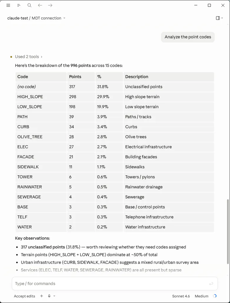
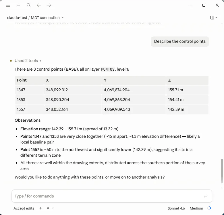
We can get details about points with specific codes, for example:
Describe the control points
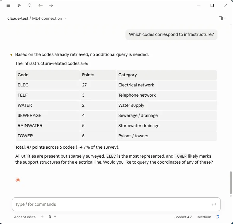
More general questions are also possible, for example:
Which codes correspond to infrastructure?
Which codes should be breaklines?
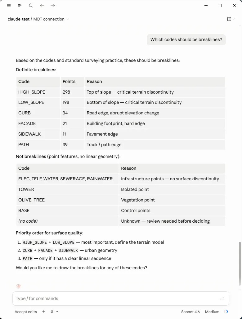
With this information we can determine which codes should be converted into breaklines so that the triangulation respects terrain discontinuities. The codes HIGH_SLOPE and LOW_SLOPE correspond to linear features with abrupt slope changes and are the most suitable candidates, although others such as the road edges PATH could also be defined.