
tcpMDT
Interpolate - MDT25
2.14 Interpolate
For various reasons, some projects may have areas with a low point frequency, which makes triangulation and contouring processes difficult. This command allows one to create new interpolated points from other existing points.
Firstly, the Interpolate Points dialog box containing the following elements is displayed.
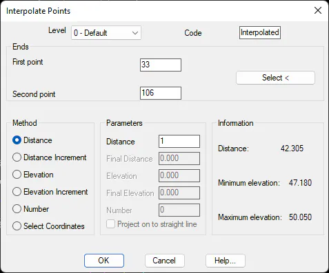
Level: Selects the level where the new points are created. The default level is the current level.
Code: Sets the code assigned to the new points created.
Select: Button used to successively mark the two points between which the interpolation will be carried out on screen.
Information: Provides details on the distance between the points selected and their minimum and maximum elevations.
Should there be a defined triangulation, it is not modified. Consequently, it is necessary to triangulate once again if one wishes to include the interpolated points in the triangulation.
Interpolation by Distance
New points are inserted having interpolated elevations between them from the two points selected, going from the first reference point to the second point, and according to the distance specified.
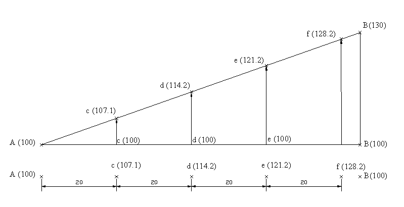
In the figure above, points are interpolated every 20 meters between the A and B reference points.
Interpolation by Distance Increment
It is similar to the Interpolation by Distance method, but with the difference that in this case one also indicates the final distance up to which one wishes to draw. One can therefore insert points after the second reference point.
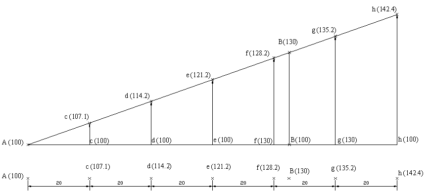
In the figure above, points are interpolated every 20 meters between the initial reference point and the final distance specified, which in this case is 120 meters.
Interpolation by Elevation
A point is inserted having the elevation entered between two points to be interpolated.
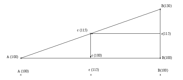
In the figure above, point C is interpolated between the A and B reference points by specifying its elevation, which in this case is 115 meters.
Interpolation by Elevation Increment
Allows one to interpolate a series of points, so that the points interpolated from the first reference point and according to the increment specified are inserted until the final elevation is reached. This option allows one to include points after the second reference point.
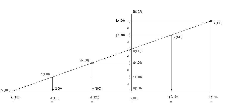
In the figure above, points are interpolated every 10 meters of elevation between the first reference point and the final elevation specified, which in this case is 155 meters.
Interpolation by Number
This option allows one to insert the number of points specified between the two points to be interpolated, so that they remain equidistant between them and the two interpolation reference points.
Should a defined triangulation exist, it cannot be modified. It is therefore necessary to triangulate again.
Interpolation by Designating Coordinates
This option allows one to select the coordinates of the point to be interpolated and the program assigns the corresponding elevation to the lineal interpolation between the two points designated. Additionally, if the Project onto Straight Line check box is activated, the program also ensures that the new point's X and Y coordinates are projected on the straight line between the points chosen.