
tcpMDT
Cross Section Difference - MDT26
Cross-section Difference
 | Command to execute in the CAD |
|---|---|
Vertical menu | MDT26 > Measurements > Volumes > Profile Difference |
Ribbon menu | Volumes > Terrain > Cross-Section Difference |
Command line |
This option obtains the volume between two terrains from two cross-section profiles. These should have the same stations defined along the horizontal alignment. The program requests the files and displays the following dialog box, where the list is configured. A description of all its characteristics follows.
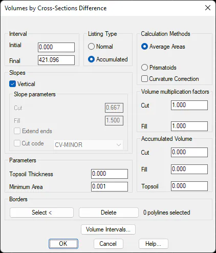
Initial Station: Station from which the volume measurement will be calculated.
Final Station. Station up to which the volume measurement will be calculated.
Slopes
Vertical: This option is activated by default. To calculate the surface at each station, make a vertical cut on one side and another in the shortest profile, so that the calculation is made as if it were defining a slope.
If the option is deactivated, instead of all slopes being vertical, one slope can be specified a slope for Cut and another for Fill.
Extend ends: If when forming the slope indicated the terrain in the first cross-section is not wide enough for the cut, it is automatically extended, interpolating with the two last vertices of each side as a reference. Cut code: This option is the alternative to introducing specific cut and fill slopes. The cut code is indicated for it, meaning from the ends of the second selected cross-section, the cut is completed by seeking contact with the vertex of the first cross-section with the code indicated in the list. If there is no code, the cut will be vertical.
Parameters
Topsoil Thickness: Sets the organic soil value for the volume measurement calculation.
Minimum surface: Sets the minimum surface admissible on the list. Any values that are lower are considered as zero.