tcpMDT
Basins - MDT26
 | Command to execute in the CAD |
|---|---|
Vertical menu | MDT26 > Maps > Hydrology > Basins |
Ribbon menu | Maps > Hydrology > Hydrographic Basins |
Command line |
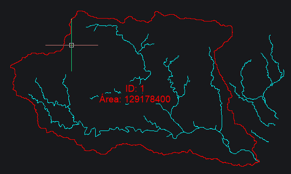
This command automatically delimits the hydrographic basins (catchment areas) of the study area from the preprocessed terrain model. It requires as input the depression-filled terrain model and the flow direction raster calculated in the previous steps of the hydrological analysis.
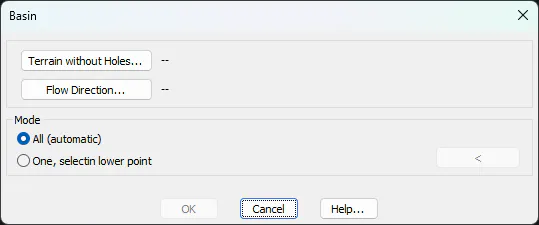
There are two modes of operation. The All (automatic) option automatically delimits all identifiable catchments in the study area. On the other hand, the One, selecting a lower point option allows you to delimit a single catchment basin, manually indicating a point on the screen, for example a vertex of a polyline obtained with the drainage network command.
Results Window
Once the command is executed, the results window appears showing the list of calculated basins and the options to filter and draw them in the drawing.
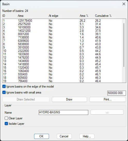
The central table shows all the detected basins. The header indicates the total number of basins calculated. The columns are:
ID: Numerical identifier of each basin.
Area: Surface area of the basin in square meters.
At Edge: Indicates whether the basin touches the model's boundary (Yes) or is completely inside (No). Edge basins may be incomplete.
%Area The percentage that this basin represents over the total area of the model.
%Cumulative Percentage accumulated from the largest basin to the current one, ordered from largest to smallest.
In the Draw and Print buttons, you can activate filters to Ignore basins at the edge of the model (surely the model is missing, and the actual basin will be larger) and Ignore basins with small area lower than a value that we consider negligible.
One or more arbitrary basins can be drawn by selecting lines from the list, and clicking the Draw Selected button.