
tcpMDT
Volumes - MDT26
Volumes
Configuration parameters to calculate earthwork volumes, as well as to compare areas and volumes. Consult the Reference Manual for further details.
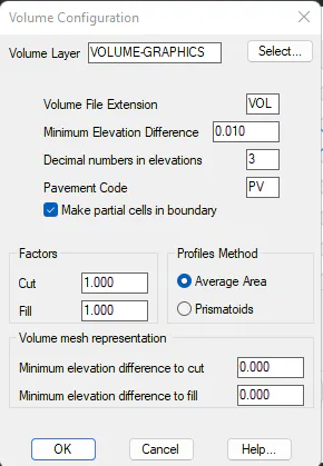
Volume Layer (Volume). Name of the layer where volumes are represented graphically.
Volume File Extension (VOL). Extension for files that store volume calculation information.
Minimum Elevation Difference (0.05). Minimum difference in meters so that volume may be calculated.
Decimal numbers in elevations (3). Number of decimals for height values in volume reports.
Pavement Code (PV): A code to differentiate between the pavement on road applications.
Make partial cells on the boundary (1): When this option is activated the Volume by Surfaces and Volume by Grid commands will only partially process the cells within the perimeter of the calculation area.
Use partial cells on the boundary | |
|---|---|
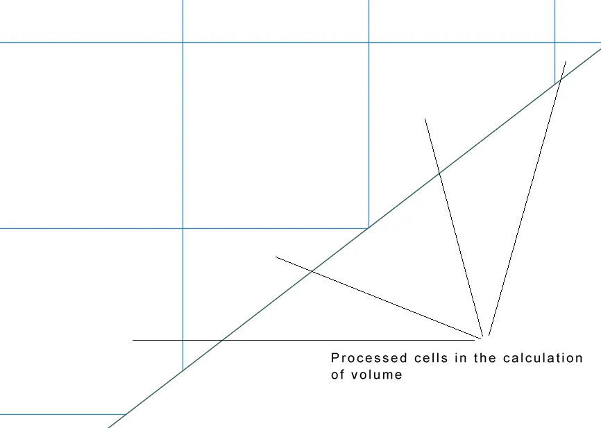 | 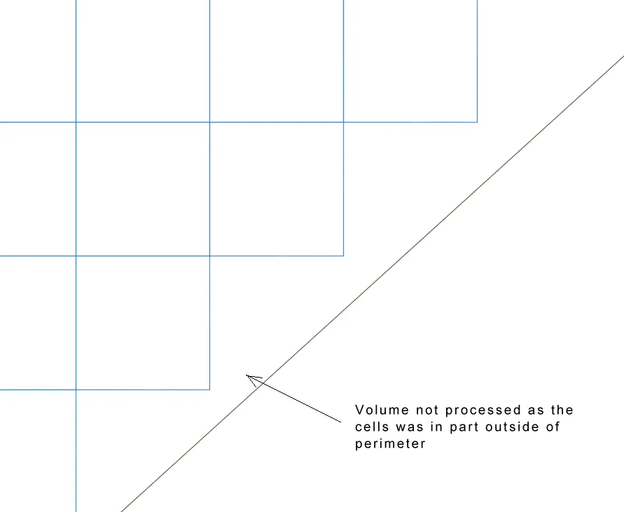 |
ACTIVATED | DEACTIVATED |
Cutting Factor (1.0): Factor applicable to a cutting surface.
Fill (1.0): Factor applicable to a fill surface.
Profiles Method. Allows one to select from either the Average Area or
Prismatoids methods. Consult the Volumes > Volume Measurement Report command for further details.
Volume grid representation
Minimum elevation difference for cut: For cut values whose increase in elevation is less than this value, cells will be drawn in white color.
Minimum elevation difference for fill : For fill values whose increase in elevation is less than this value, cells will be drawn in white color.